GUFFEY

Guffey, Colorado
  • Founded in 1894, at an elevation of 8,658 feet.

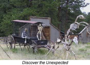
  • Once called "Freshwater", this little western town awaits the traveler who wants to discover the unexpected.

  • Just off US Hwy 9, near the southern edge of Park County, Guffey's history runs from an early venture in mining to a more successful commerce center for the area ranches.

  • Independent and creative, the residents of Guffey have maintained the historic buildings of an earlier time and reveal a high percentage of talented artists in the area.

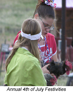
  • A favorite local event is the annual Heritage Days on the Fourth of July, which has drawn photographers and fans from all over the United States to witness.

  • Guffey, Colorado
  • A camera is a must when visiting Guffey and its late 1800s buildings, charming restaurants, and galleries.  Guffey also offers rustic guest cabins built in the late 1800s for a fun experience back to the time of the early residents.

  • The town and surrounding area is home to a number of artists and visitors are encouraged to tour this historic town and stop at the Guffey Caldera Art Gallery.

  • The Guffey caldera (basin) is part of a much larger volcanic complex that includes Florissant Fossil Beds National Monument.

  • Guffey sprang up following the 1859 "Pikes Peak or Bust" gold rush.

  • The oldest living trees in the Rocky Mountains (up to 2500 years old) still grow on Black Mountain and Thirty Nine Mile Mountain above town.  County Road 102 through Guffey serves as a western portal to the Gold Belt Tour National Scenic Byway.


Wildlife

  • Guffey offers the Best Big Game Hunting Areas in the state.  The 3,782 acre Agate Mountain (Game Management Unit 58) is located south of Hartsel on County Road 53.  It is open from Sep 1st through Feb 28th.  To reach the GMU, go 1.75 miles south on US Hwy 9 from Hartsel.  At County Road 53, turn and go south 15 miles to the parking area on the south side of County Road 53.  The 640 acre Saddle Mountain (GMU 581) is located 6 miles north of Guffey on County Road 59.  It is open from Sep 1st through Feb 28th.  To reach the GMU, go 6 miles north of Guffey on County Road 59 to the National Forest Boundary.  Go east 1.5 miles over the mountain by foot or horseback.


Trails

Trail # Trail Name Usage Length Environment Trail Features
FR-270/253/254   MB, OHV 14 miles Forest, Meadow Remote Two-Track Road
FR-258/261   MB, OHV 3 miles Open Forest Remote Two-Track Road
FR-257/265/268/269   MB, OHV 30 miles Open Forest Remote Two-Track Road

TRAIL GUIDE KEY

Route Number Key (Route numbers may differ on various maps)

CR = County Road (asphalt or gravel surface suitable for passenger vehicles)
FR = Forest Road (improved dirt roads, two-track roads, and high clearance 4WD roads)
FT = Forest Trail (single track trail, includes bother motorized and non-motorized vehicles)

Suggested Use Key - Suggested uses are based on user feedback and US forest Service Travel restrictions.  Road and Trail restrictions are subject to change over time.

SC = Seasonal Closure (generally between January 1st and early June of each year)
TH = Trailhead (parking area)
HK = Hiking
BP = Backpacking
MB = Mountain Biking
EQ = Equestrian or pack animal use
4WD = Highway-legal vehicles with high clearance and 4-wheel drive capability
OHV = Off-highway vehicles that are not highway legal (four-wheelers, ATVs, and dirt bikes)
MC = Motorcycles (dirt bikes)
PC = Passenger Cars
CG = Campground

Notice:  Many of the roads and trails described above are closed on a seasonal basis to protect wildlife.  Please respect all closures and stay on designated routes to prevent resource damage.